Conny Waters – AncientPages.com – The first-ever use of cutting-edge drone-based lidar in Central Asia allowed archaeologists to capture stunning details of two newly documented trade cities high in the mountains of Uzbekistan.
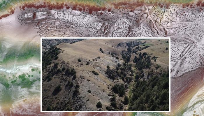
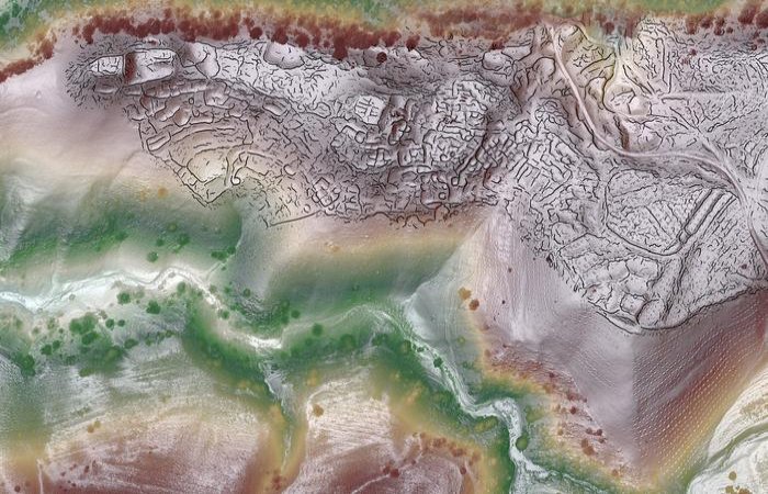
Composite lidar view of Tugunbulak. Image credit: SAIElab/J.Berner/M.Frachetti
A team of researchers led by Michael Frachetti, professor of archaeology in Arts & Sciences at Washington University in St. Louis, and Farhod Maksudov, director of the National Center of Archaeology in Uzbekistan, used drone-based lidar to map the archaeological scale and layout of two recently discovered high-elevation sites in Uzbekistan. The medieval cities are among the largest ever documented in the mountainous parts of the Silk Road, the vast network of ancient trade routes that connected Europe and Eastern Asia.
Images and details of the discovery were recently published in Nature. Co-authors include Jack Berner, a graduate student in the Department of Anthropology at WashU; Edward Henry, an assistant professor of anthropology and geography at Colorado State University and WashU alum (PhD ’18); Tao Ju, a professor of computer science and engineering in the McKelvey School of Engineering at WashU; and Xiaoyi Liu, an undergraduate student in the McKelvey School of Engineering at WashU. The expedition was supported by the National Geographic Society.
The drone-lidar scans provided remarkably detailed views of the plazas, fortifications, roads, and habitations that shaped the lives and economies of highland communities, traders, and travelers from the sixth through 11th centuries in Central Asia. The two cities are located in rugged terrain 2,000 to 2,200 meters above sea level (roughly comparable to Machu Picchu in Peru), making them unusual examples of thriving mountain urbanism.
The smaller city, today called Tashbulak, covered about 12 hectares, while the larger city of Tugunbulak reached 120 hectares, “making it one of the largest regional cities of its time,” Frachetti said.
A drone captured images of Tugunbulak in 2018. Credit: Michael Frachetti
“These would have been important urban hubs in central Asia, especially as you moved out of lowland oases and into more challenging high-altitude settings,” he said. “While typically seen as barriers to Silk Road trade and movement, the mountains actually were host to major centers for interaction. Animals, ores, and other precious resources likely drove their prosperity.”
“This site had an elaborate urban structure with specific material culture that greatly varied from the lowland sedentary culture,” Maksudov said. “It’s clear that the people inhabiting Tugunbulak for more than a thousand years ago were nomadic pastoralists who maintained their own distinct, independent culture and political economy.”
Lidar technology is commonly used to map archaeological landscapes blocked by dense vegetation, but it has additional value where vegetation is sparse, such as the mountains of Uzbekistan. “Drone operation is strictly regulated in Uzbekistan, so this discovery is also thanks to the political support and permissions we received through local partners and government,” Frachetti said.
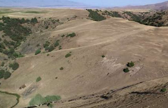
A drone captured images of Tugunbulak in 2018. Credit: Michael Frachetti
The centimeter-level scans allowed for advanced computer analysis of the ancient archaeological surfaces, providing an unprecedented view of the cities’ architecture and organization. “These are some of the highest-resolution lidar images of archeological sites ever published,” Frachetti said. “They were made possible, in part, because of the unique erosion dynamics in this mountain setting.”
Frachetti, Maksudov, and their team first discovered the highland cities using predictive computer models and old-fashioned foot surveys between 2011 and 2015, tracing presumed routes of the Silk Road in southeastern Uzbekistan. The project took years to materialize. The extra time ultimately proved to be a blessing, allowing the researchers to make the most of the latest advances in drone-based lidar. “The final high-res maps were a composite of more than 17 drone flights over three weeks,” Frachetti said. “It would have taken us a decade to map such large sites manually.”
Frachetti and graduate students in his Spatial Analysis, Interpretation, and Exploration (SAIE) Lab compiled the drone-lidar data into 3D models, which were passed to Liu and Ju, who applied computational algorithms to analyze the archaeological surfaces and auto-trace millions of lines to predict likely architectural alignments.
The final step was to match the digital output with comparable architectural cases, revealing a huge ancient city otherwise invisible to the naked eye. “The project reflects a truly interdisciplinary effort,” Ju said. “The analysis techniques have potential applications in many domains that utilize lidar scans.”
Both cities warrant much closer inspection, Frachetti said. Preliminary digging at one of the fortified structures at Tugunbulak suggests that the fortress—a building protected by three-meter-thick rammed earth walls—might have been a factory where local metalsmiths turned rich deposits of iron ore into steel. Such industry would have been a key feature of the city and its economy.
It’s already clear that Tashbulak and Tugunbulak weren’t just remote outposts or rest stops. “The Silk Road wasn’t just about the endpoints of China and the West,” Frachetti said. “Major political forces were at play in Central Asia. The complex heart of the network was also a driver of innovation.”
Frachetti hopes to use the same combination of on-the-ground detective work and drone-based lidar to get pictures of other high-altitude settlements along the Silk Road and beyond. “We could really change the map of urban development in medieval Asia,” he said.
Written by Conny Waters – AncientPages.com Staff Writer


